

| Online: | |
| Visits: | |
| Stories: |

Hidden Napa Earthquake Faults Found By NASA Radar (Video)
Saturday, September 13, 2014 5:36
% of readers think this story is Fact. Add your two cents.

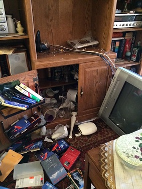
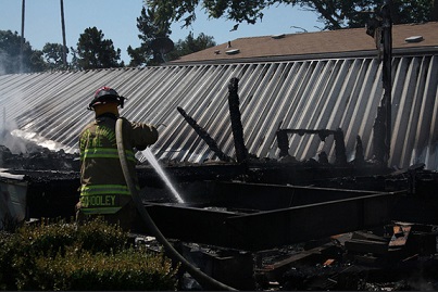
(N.Morgan) On August 24th, Napa Valley experienced a 6.0 magnitude earthquake, that awoke a previously unrecognized faults, according to the first results from a high-flying NASA radar instrument. The quake injured 170 people and killed one woman, who died from a brain bleed due to a television falling on her. Some 800 homes were damaged, and 103 have been deemed too dangerous to enter. Most of the damage was centered on the West Napa Fault. The U.S. Geological Survey (USGS) found that the West Napa Fault moved a total of 18 inches (46 centimeters) along a 9.3-mile-long (15 kilometers) length, USGS scientist Dan Ponti said Sept. 4 at a USGS earthquake seminar.
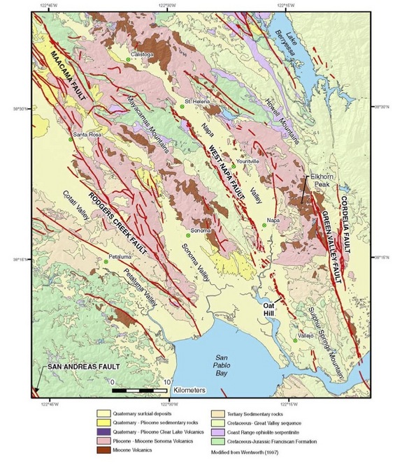
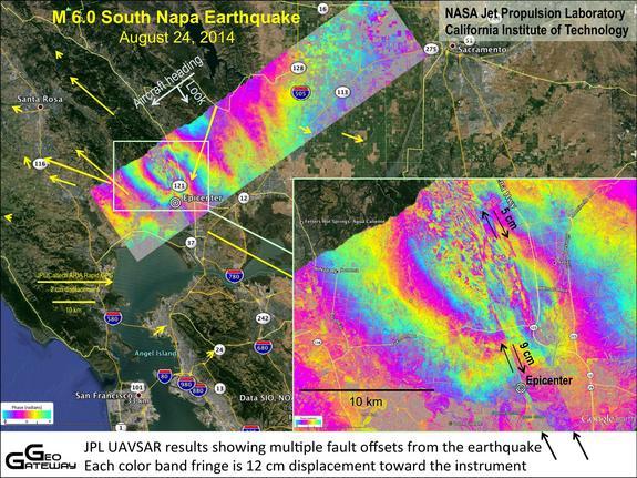
New radar images of Napa Valley also confirm that the West Napa Fault caused the deadly earthquake. But the remarkable detail of the images also reveals a handful of smaller faults running roughly northwest to southeast, parallel to the West Napa Fault. While these newly found faults let off the region’s pent-up strain, they may never trigger their own quake. “These really tiny ones are probably not big enough faults to have a significant earthquake, but it’s a good thing to have people go out and check whether they are part of a larger fault system,” said Eric Fielding, a geophysicist at NASA’s Jet Propulsion Laboratory (JPL) in Pasadena, California. The radar images were created from UAVSAR (uninhabited aerial vehicle synthetic aperture radar) data collected during flights on May 29, 2014, three months before the quake, and on Aug. 29, 2014, five days after the quake. The UAVSAR detects surface changes between repeat flights over the same spot. UAVSAR can measure ground movements of less than a half-inch (1 cm). The UAVSAR team has prepped for earthquakes by systematically mapping California’s faults, starting in 2009.
With the UAVSAR data, the USGS and the California Geological Survey mapping teams discovered new areas of ground damage, Fielding told Live Science. For example, the UAVSAR team spied movement at the Napa County Airport, and geologists confirmed a small crack with less than a half-inch of slip ran across the runway. JPL scientists hope to fly the UAVSAR instrument over Napa again in October, Fielding said. The flight would document the afterslip, or movement on faults in the days after an earthquake. The Napa earthquake afterslip — a few inches so far — bumps the earthquake’s magnitude to 6.1, USGS scientists said.
More Stories Contributed By N. Morgan


Maybe NASA can use that radar to find the aliens hidden under Dulce Base so that won’t have to go to Mars and claim tehy are looking for aliens!
http://www.blue-planet-project.com/Secrets-of-Dulce-Base.html
The Alien Intervention is The greatest threat to humanity. Until those in power who know
Come forward the people will have to unite and take it to the streets! This is the only way we
Can stop the collectives before they leave earth barren. Allies of humanity explain our only hope.