

| Online: | |
| Visits: | |
| Stories: |

New Digital Map Reveals Stunning Hidden Archaeology Of Stonehenge (Video And Photos)
Wednesday, September 10, 2014 15:51
% of readers think this story is Fact. Add your two cents.

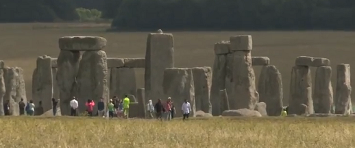
(N.Morgan) In an exciting discovery, previously unknown archaeological monuments have been discovered around Stonehenge. This latest find was a part of an unprecedented digital mapping project that will transform our knowledge of this iconic landscape – including remarkable new findings on the world’s largest ‘super henge’, Durrington Walls. Stonehenge has always been a place of mystery and wonder and now we have another piece of the puzzle. The Stonehenge Hidden Landscapes Project, led by the University of Birmingham in conjunction with the Ludwig Boltzmann Institute for Archaeological Prospection and Virtual Archaeology, is the largest project of its kind. Remote sensing techniques and geophysical surveys have discovered hundreds of new features which now form part of the most detailed archaeological digital map of the Stonehenge landscape ever produced.
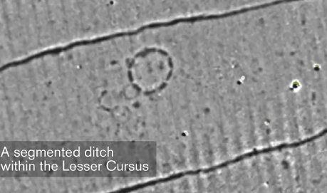
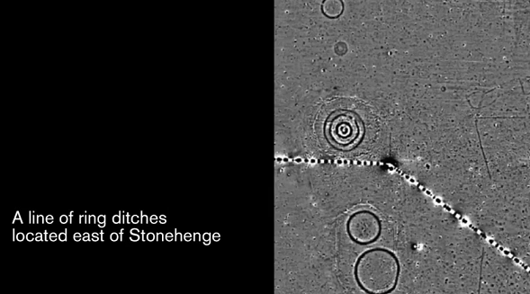
The startling results of the survey, unveiled in full at the British Science Festival, include 17 previously unknown ritual monuments dating to the period when Stonehenge achieved its iconic shape. Dozens of burial mounds have been mapped in minute detail, including a long barrow (a burial mound dating to before Stonehenge) which revealed a massive timber building, probably used for the ritual inhumation of the dead following a complicated sequence of exposure and excarnation (defleshing), and which was finally covered by an earthen mound. The project has also revealed exciting new – and completely unexpected – information on previously known monuments. Among the most significant relate to the Durrington Walls ‘super henge’, situated a short distance from Stonehenge. This immense ritual monument, probably the largest of its type in the world, has a circumference of more than 1.5 kilometers (0.93 miles). A new survey reveals that this had an early phase when the monument was flanked with a row of massive posts or stones, perhaps up to three meters high and up to 60 in number – some of which may still survive beneath the massive banks surrounding the monument. Only revealed by the cutting-edge technology used in the project, the survey has added yet another dimension to this vast and enigmatic structure.
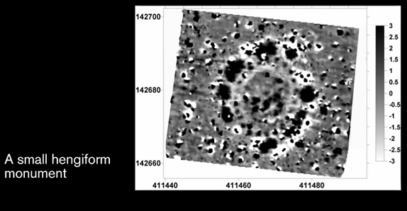
Work also revealed novel types of monument including massive prehistoric pits, some of which appear to form astronomic alignments, plus new information on hundreds of burial mounds, Bronze Age, Iron Age and Roman settlements and fields at a level of detail never previously seen. Taken together, these results – which will be featured in a major new BBC Two series titled Operation Stonehenge: What Lies Beneath – show that new technology is reshaping how archaeologists understand the landscape of Stonehenge and its development over a period of more than 11,000 years. In the year marking the centenary of the First World War, the new Stonehenge map even impacts on our knowledge of that momentous event. Surveys have produced detailed maps of the practice trenches dug around Stonehenge to prepare troops for battle on the western front, as well as maps of RAF/RFC Stonehenge – one of Britain’s first military airbases used by the Royal Flying Corps between 1917 and 1920. British project leader Professor Vincent Gaffney, Chair in Landscape Archaeology and Geomatics at the University of Birmingham, said: ‘The Stonehenge Hidden Landscapes Project is unique at a global level. Not only has it revolutionised how archaeologists use new technologies to interpret the past, it has transformed how we understand Stonehenge and its landscape. ‘Despite Stonehenge being the most iconic of all prehistoric monuments and occupying one of the richest archaeological landscapes in the world, much of this landscape in effect remains terra incognita.
‘This project has revealed that the area around Stonehenge is teeming with previously unseen archaeology and that the application of new technology can transform how archaeologists and the wider public understand one of the best-studied landscapes on Earth. ‘New monuments have been revealed, as well as new types of monument that have previously never been seen by archaeologists. All of this information has been placed within a single digital map, which will guide how Stonehenge and its landscape are studied in the future. Stonehenge may never be the same again.’
More Stories Contributed By N. Morgan
