


The Maps Lie | Nothing Is Where You Think It Is

Boston Schools recently announced that they would be changing the maps they use to
teach children in order to correct over 500 years of distortion.
But is the so called distortion really being corrected? Apparently not.
The change was made, a switch from the Mercator map made in the 1500′s to
the Gall-Peters map made in 1855 and republished in 1976, but both of the maps
are incorrect and seriously lacking in accuracy.
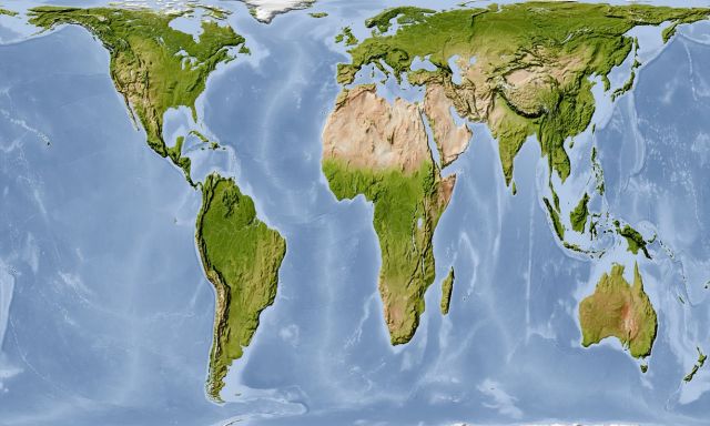
While the new maps correct scale somewhat they show very distorted landmasses
giving a very disturbing visual of the world.
An even bigger question poses itself as we look at this issue. Why are schools
in the year of 2017 using maps to teach children made in the 1500′s? Not
all schools have made the switch. Why when it was found necessary to correct the maps were they replaced with inaccurate and distorted maps from the 1800′s?
The 1800′s really?
In this day and age, with all the technology available to us, and literally thousands
of satellites circling the earth, are there not more current and accurate maps available?
Would we find it acceptable if schools were using textbooks from the 1500′s to teach children?
The earth is a constantly changing environment, new landmasses are created and others
sink to the sea every day. Surely we would want an accurate depiction of the
world we live in for both our children and ourselves. In order to navigate this thing we call life
it is necessary to have and accurate understanding of the medium we are trying to exist in.
Why are we not being given one when the tools to do so are supposedly available, and
even more importantly why are we not questioning this?
