
| Visitors Now: | |
| Total Visits: | |
| Total Stories: |
Shallow and dangerous M 5.6 earthquake struck eastern Iran
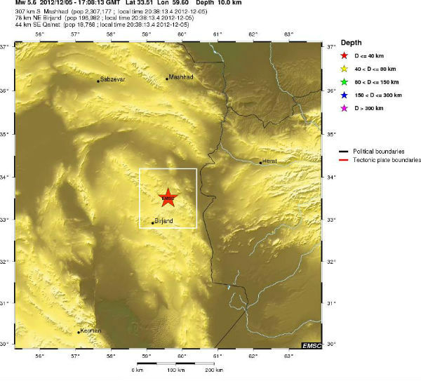
Strong earthquake, initially registered as M 6.0, but later revised to M 5.6 hit South Khorasan Province in eastern Iran at 17:08 UTC on December 5, 2012. The epicenter was located 18 km E of Khoshk, 22 km W of Zahan, The epicenter was at depth of 5.4 km according to USGS and 10 km according to EMSC. USGS and EMSC recorded same magnitude while IIEES recorded M 5.4 at depth of 14,1 km. There are still no report of damage or injuries at the moment.
| Magnitude | 5.6 |
|---|---|
| Date-Time |
|
| Location | 33.520°N, 59.570°E |
| Depth | 5.4 km (3.4 miles) (poorly constrained) |
| Region | EASTERN IRAN |
| Distances | 42 km (26 miles) ESE of Qayen, Iran 79 km (49 miles) NNE of Birjand, Iran 123 km (76 miles) SE of Gonabad, Iran 175 km (108 miles) SW of Taybad, Iran |
| Location Uncertainty | horizontal +/- 13.4 km (8.3 miles); depth +/- 5.9 km (3.7 miles) |
| Parameters | NST=202, Nph=205, Dmin=507.6 km, Rmss=1.07 sec, Gp= 43°, M-type=teleseismic moment magnitude (Mw), Version=8 |
| Source |
|
| Event ID | usc000e4lq |
View current seismicity in this region
Last 24 Hours Last Seven Days Last 30 Days
The epicenter was located between three active faults – 40 km from Abriz fault, 42 km from Nozad fault and 54 km from Ferdows fault.
Featured image: EMSC + Google Earth
Shallow and dangerous M 5.6 earthquake struck eastern Iran
Related posts:
- Two extremely dangerous earthquakes M6.4 and M6.3 struck northwestern Iran Northwestern Iran was struck by two strong and very shallow...
- M 5.5 earthquake hit northern Iran Earthquake M 5.5 hit northern Iran on November 7, 2012...
2012-12-06 04:15:28
Source:


