(Before It's News)
Sad news from Washington State this weekend, after a major landslide killed several people near the town of Oso. We’re hoping the missing are soon accounted for and are alive and well.
Geologically speaking, landslides are commonplace throughout the Pacific Northwest which mostly sits on a thick pile of unstable layers of volcanic ash, tuff, and debris flows that are regularly shaken by earthquakes.
But when we looked at imagery of this area, we were a bit surprised there were clear warning signs: this same area has slid before, quite dramatically, just a few years ago in January 2006. That 2006 slide temporarily dammed the river and posed a serious threat of flooding, just like this weekend’s tragic repeat. Looking at this time-series of high resolution aerial images in Google Earth, and the low-altitude air photo of the slide, it seems clear that this is dangerous terrain to build around. But as they say, hindsight is 20-20:
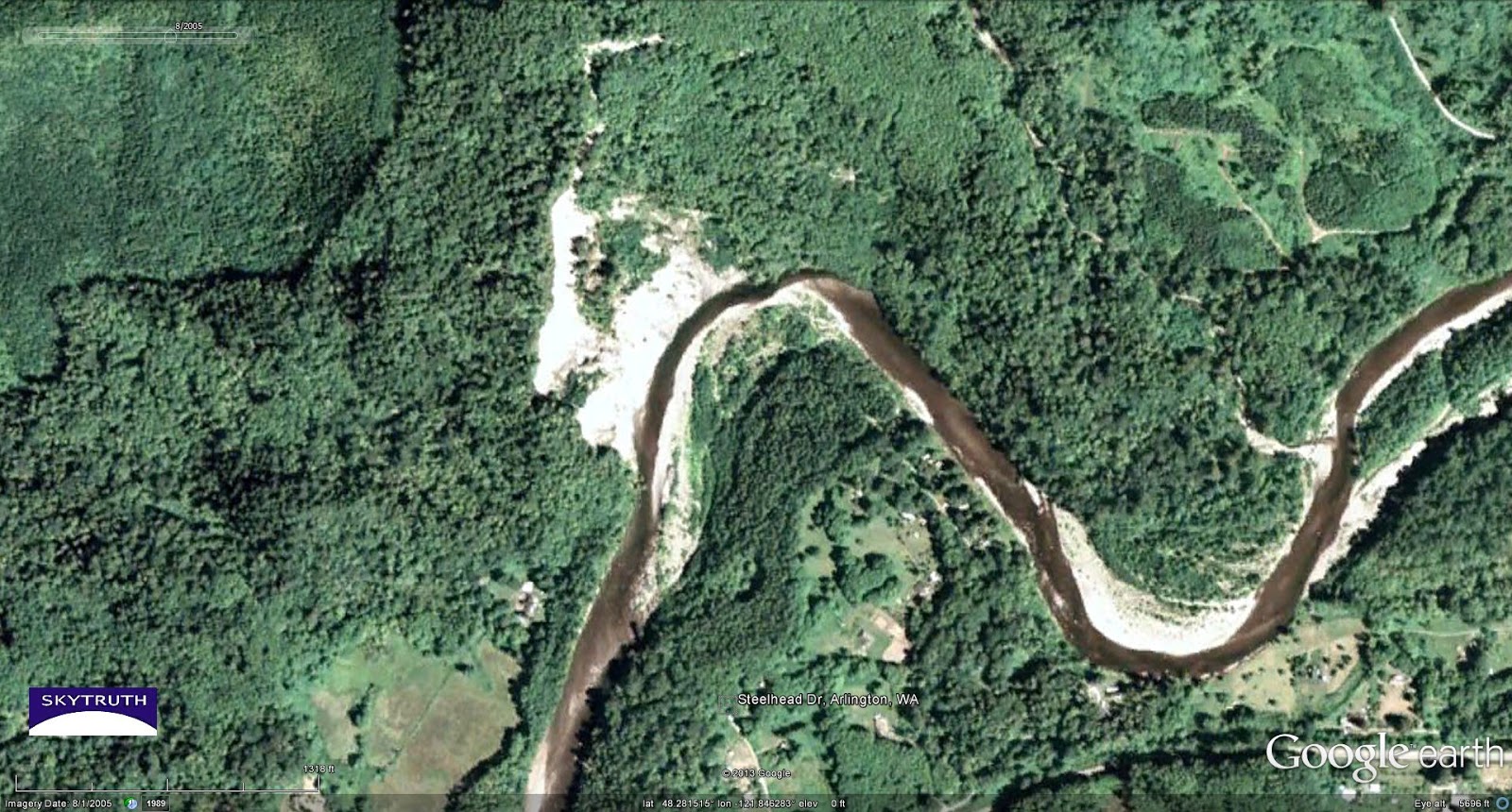 |
| Site of fatal landslide as it looked in 2005. Steelhead Drive, where several homes were hit by the flow of mud and rock, is marked for comparison to this annotated air photo of the slide area. |
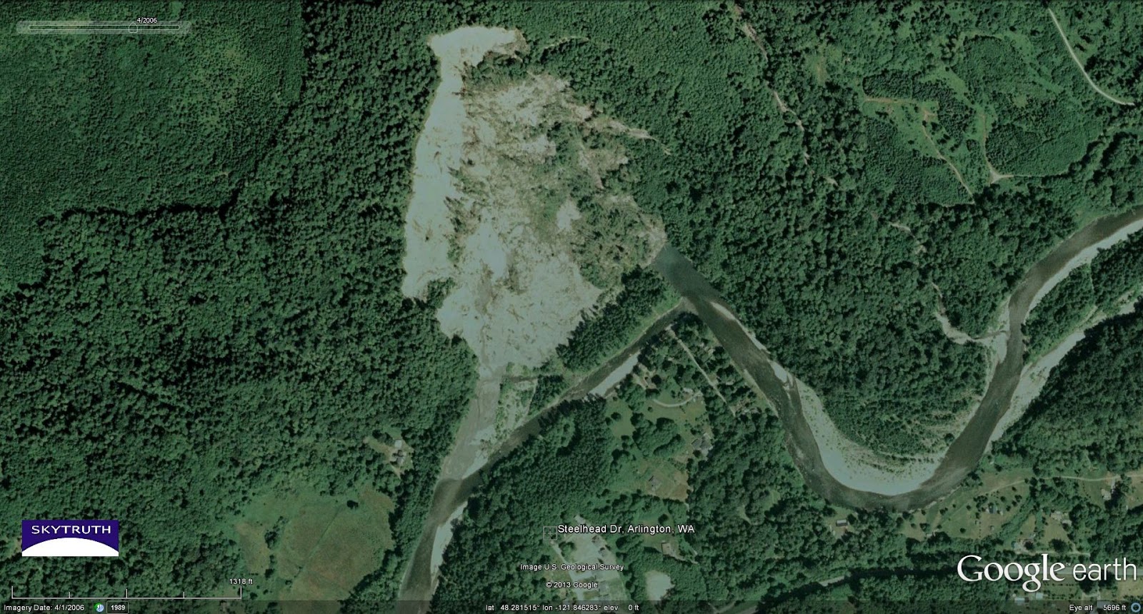 |
| Same area in 2006, after a slide that occurred in January 2006. Bright area is bare rock and soil exposed by the slide, which temporarily dammed the North Fork of the Stillaguamish River. |
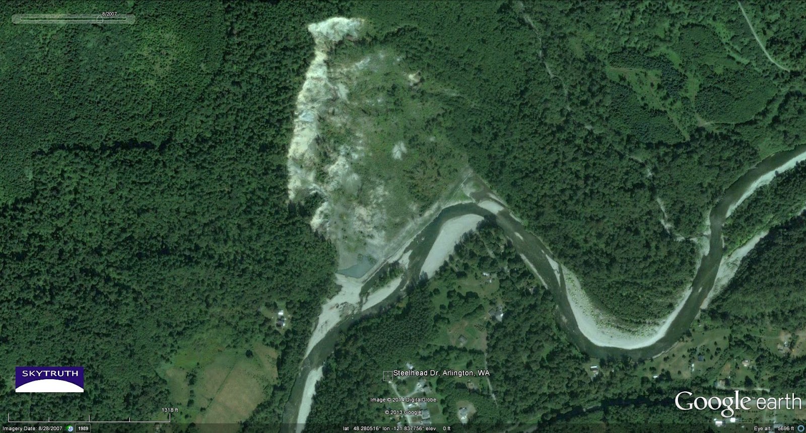 |
| Same area in 2007. Vegetation is beginning to cover the landslide debris, and the river is adjusting to the new channel. Hydraulic pressure from the river is maximized along the outside edge of a meander bend, tending to undercut the landslide debris on the north bank of the river. |
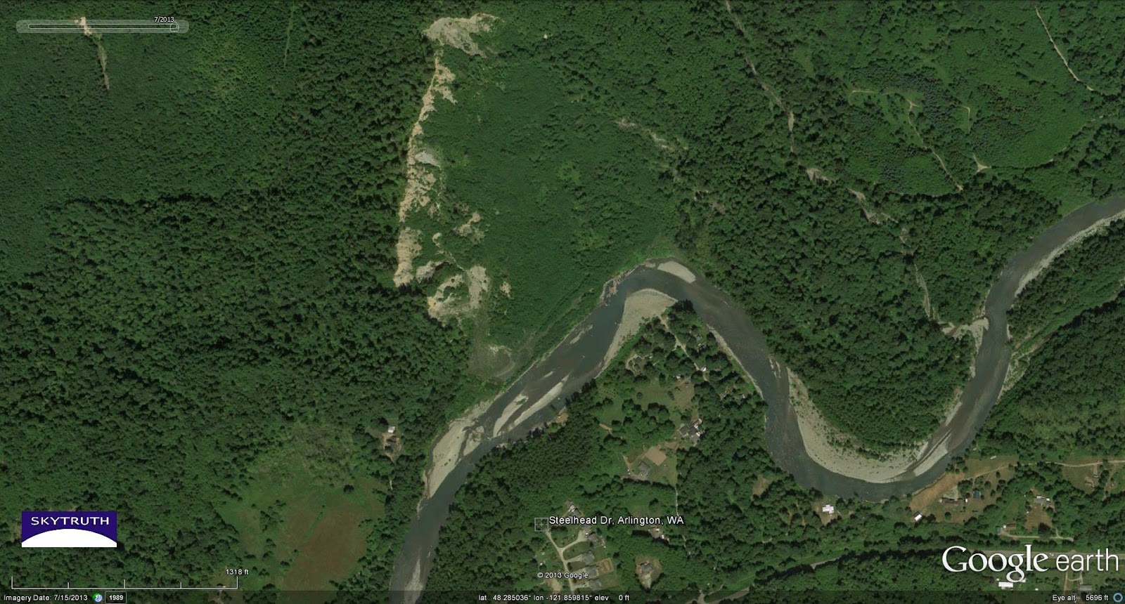 |
| Same area in 2013. New growth covers most of the 2006 landslide, but the headwall escarpment (bright area of bare rock) remains unstabilized and prone to failure. |

Source:
http://blog.skytruth.org/2014/03/fatal-landslide-in-washington-state.html


