

| Online: | |
| Visits: | |
| Stories: |

| Story Views | |
| Now: | |
| Last Hour: | |
| Last 24 Hours: | |
| Total: | |
Making a List – 2014 in Review

It’s Christmas Eve here in the U.S. and tonight there will be thousands of children keeping a close eye on the skies for a jolly man and his flying reindeer. Now while there are some engineers out there who have their doubts about the physics of ‘ol St. Nick, it is a well documented fact that some of those twinkling lights aren’t meteors or levitating caribou, but satellites that help SkyTruth know who’s being naughty or nice.
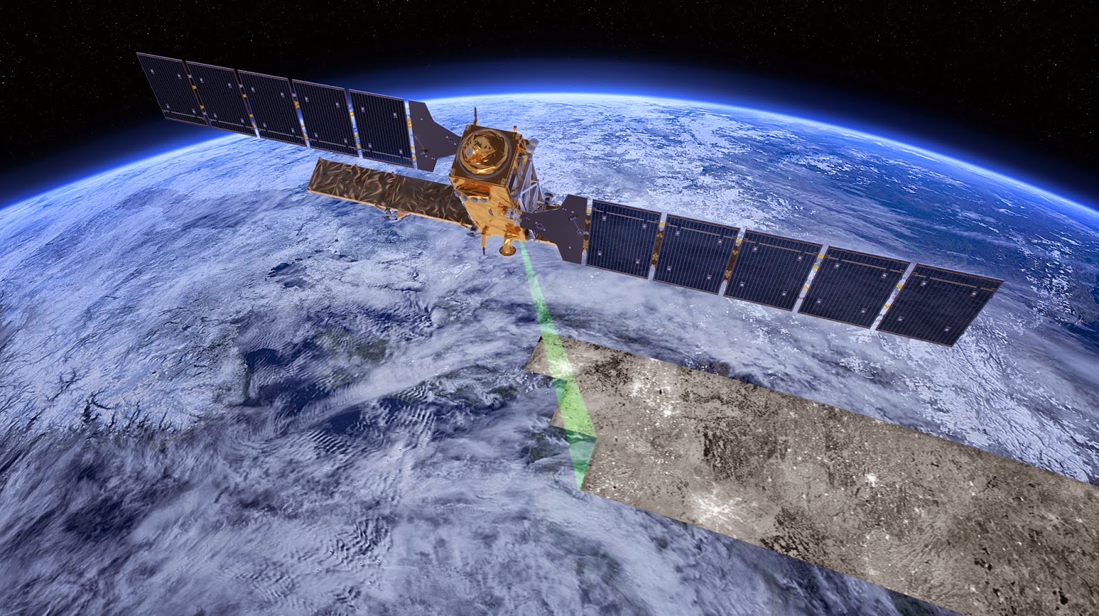
Artist’s rendering of Sentinel 1-A, a new radar satellite launched by the European Space Agency (ESA) back in April 2014. Image Credit – ESA
Unfortunately, our naughty list is usually longer than the nice list as we spot spills from oil tankers and gold mines, and watch landscapes being transformed by mining and fracking. So we need your help to keep on top of all the environmental changes happening place around the world. Will you consider making a tax-deductible donation to support our work in 2015?

 |
|
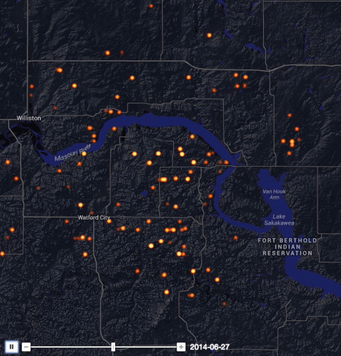
Gas flares from oil wells in North Dakota’s
Bakken Shale.
|
5. Global Flaring Map: In August, we launched a dynamic map to track the wasteful practice of natural gas flaring around the world. The SkyTruth Global Flaring Visualization compiles nightly infrared data from a NOAA satellite and filters it to display gas flares associated with oil and gas production and refining. Read more…
4. FrackFinder: Throughout 2014, several hundred volunteers contributed to our various FrackFinder projects in Pennsylvania and Ohio. Learn how citizen scientists helped map hundreds of impoundments related to shale drilling and hydraulic fracturing (fracking) in the Marcellus Shale. Read more…
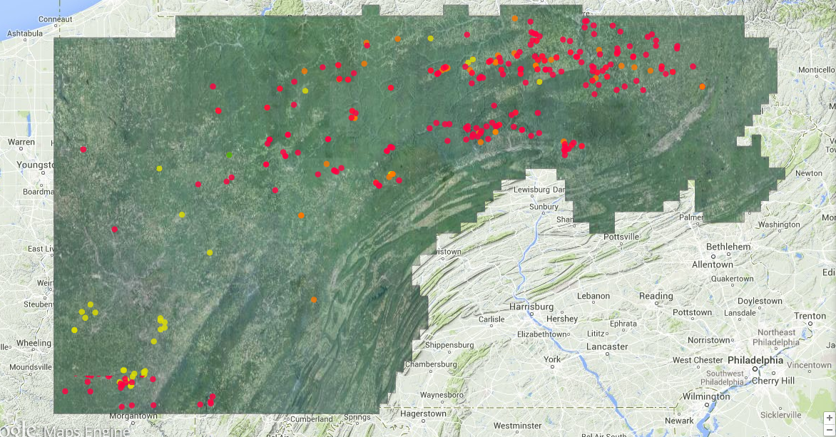 |
| This map displays impoundments related to shale gas drilling and hydraulic fracturing (fracking) in Pennsylvania, as identified by SkyTruth staff and volunteers on USDA aerial survey photography from 2005, 2008, 2010 and 2013. |
3. Malaysian Airlines Flight 370: When a commercial airliner disappeared without a trace back in March, the world wanted to know how this was possible. SkyTruth president John Amos was booked to appear on CNN several times (but they kept canceling) and quoted in the Washington Post on the limitations of our current technology. New satellites coming online will give us better coverage of humanitarian and environmental disasters, but there still needs to be someone to tell the satellites where to look and interpret the results. Read more…
2. Global Fishing Watch: Last month, SkyTruth, in partnership with Google and Oceana, announced a new technology prototype to visualize all of the trackable fishing activity in the world. The tool, introduced at the IUCN World Parks Congress in Sydney Australia, will be a powerful tool to illuminate the global fishing fleet, and help stop overfishing. Read more…
 |
|
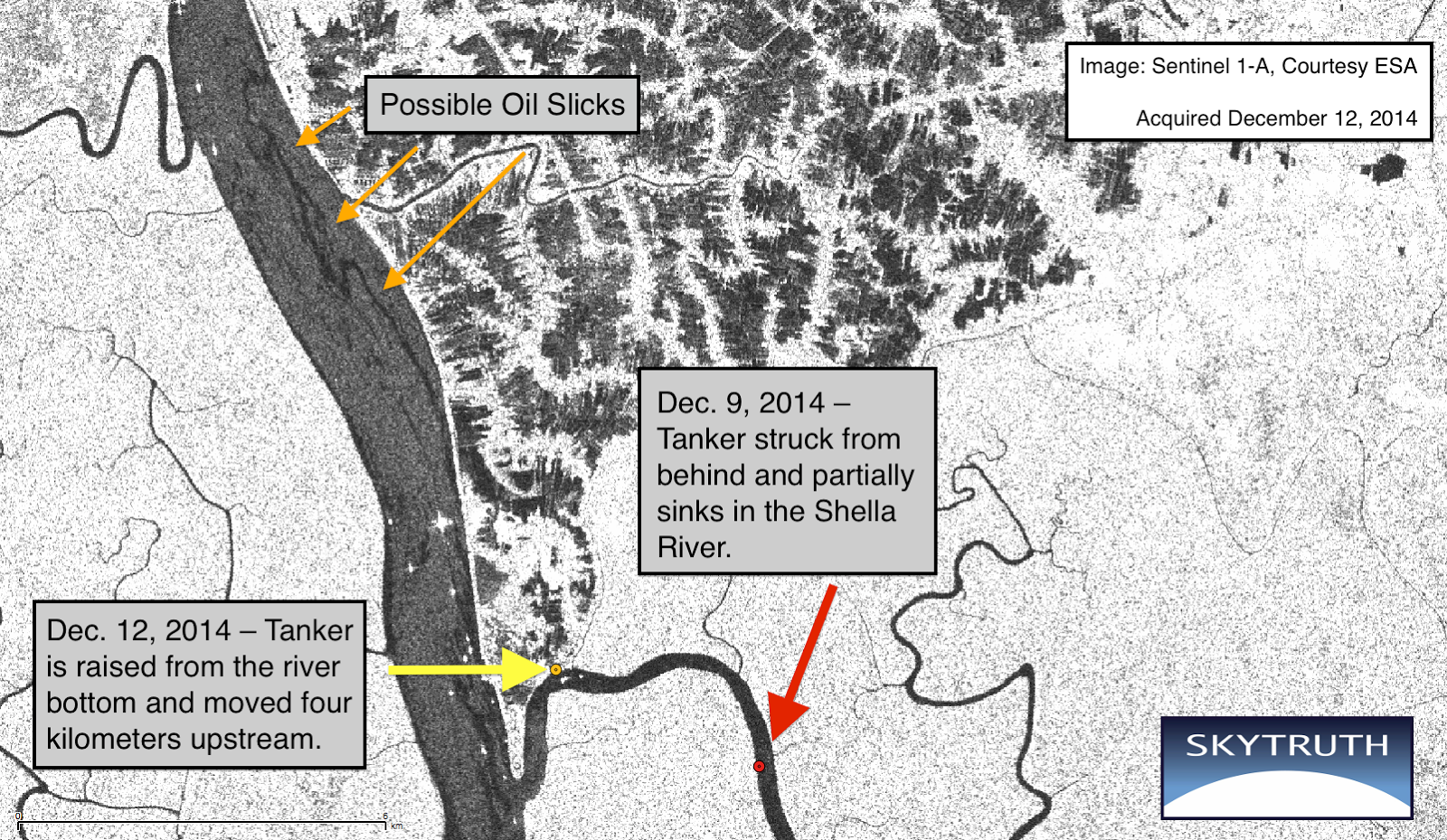
An oil spill in Bangladesh threatens rare dolphins and
what is believed to be one of the largest
populations
of the
|
Source: http://blog.skytruth.org/2014/12/making-list-2014-in-review.html
