


| Story Views | |
| Now: | |
| Last Hour: | |
| Last 24 Hours: | |
| Total: | |
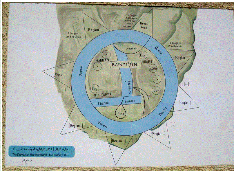
Babylonian Map Of The Word Circa 6th Century BCE
Monday, November 26, 2012 7:37
% of readers think this story is Fact. Add your two cents.

It was excavated at Sippar, southern Iraq, 100 km north of Babylon on the east bank of the Euphrates River, in 1899. It is made on a baked clay tablet and 12.2 cms tall but the tablet is damaged. It contains a number of cuneiform text which are translated below. It is dated to the 7-5th century BCE. This map is one of the first to give a view of the world as thought of by the inhabitants of Babylon. It is thought that the island locations, may also represent a mythological interpretation of the world, instead of real islands.
Read more here: http://www.abovetopsecret.com/forum/thread902226/pg1
