
| Online: | |
| Visits: | |
| Stories: |
Daily Weather Briefing for Tuesday, April 11, 2017
NATIONAL OVERVIEW
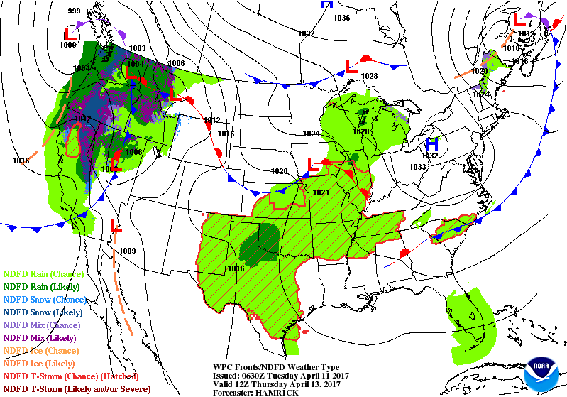
…Rain across the West Coast and Texas, and warm for the eastern states…
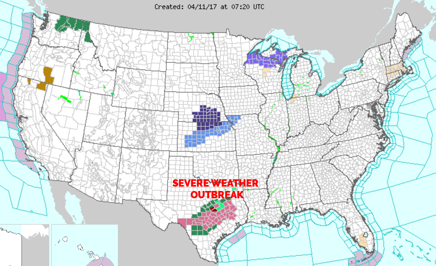
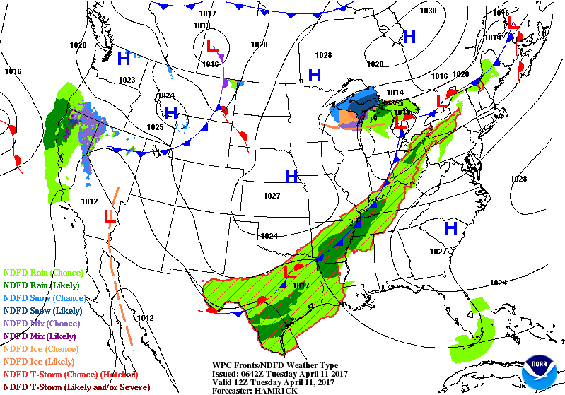
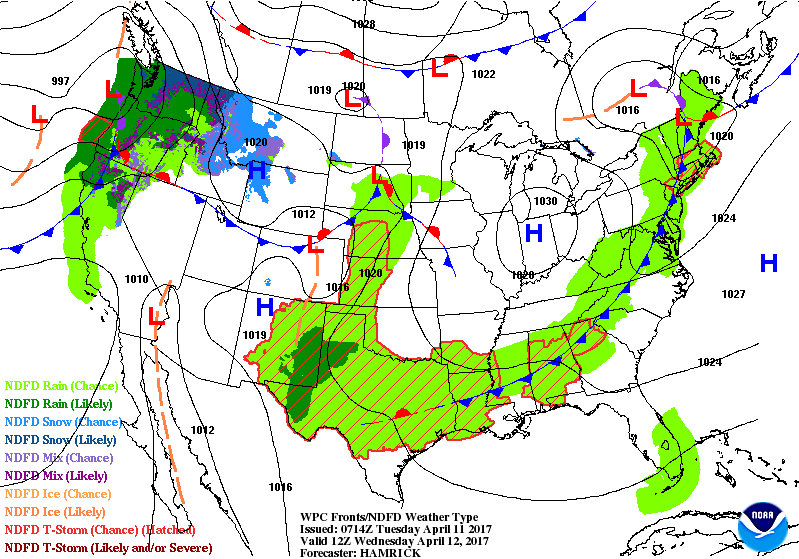
An extensive cold front stretching from central Texas northeast through the Upper Great Lakes Tuesday morning will continue to trek slowly eastward over the next few days. Along and just ahead of this front will be an area of decent moisture and lift, conducive to producing showers and thunderstorms. Severe thunderstorms will be possible across parts of Texas and the central Gulf Coast region, especially earlier in the forecast period. Areas of heavy rainfall are also likely in the vicinity of the front’s southern extent. Several inches of rainfall will be possible with the slowest moving storms, and southern Texas has the best chance for this.
After a brief break in the weather across the West Coast, a more potent system is forecast to reach the shore by midweek, bringing widespread rain from northern California northward to the Pacific Northwest and northern Great Basin starting Tuesday afternoon/evening. Additional heavy snow will be likely for the highest mountains, especially the Cascades.
Elsewhere across the eastern U.S., mostly sunny and warm conditions are expected ahead of the approaching cold front on Tuesday. Scattered showers and isolated thunderstorms are expected to arrive by the middle of the week. Some high temperature records, including record high minimums, may be met or exceeded across parts of the Northeast Tuesday. Shower and thunderstorm chances will eventually increase across the Southern and central U.S. during midweek ahead of another developing system.
LOCAL NEWS
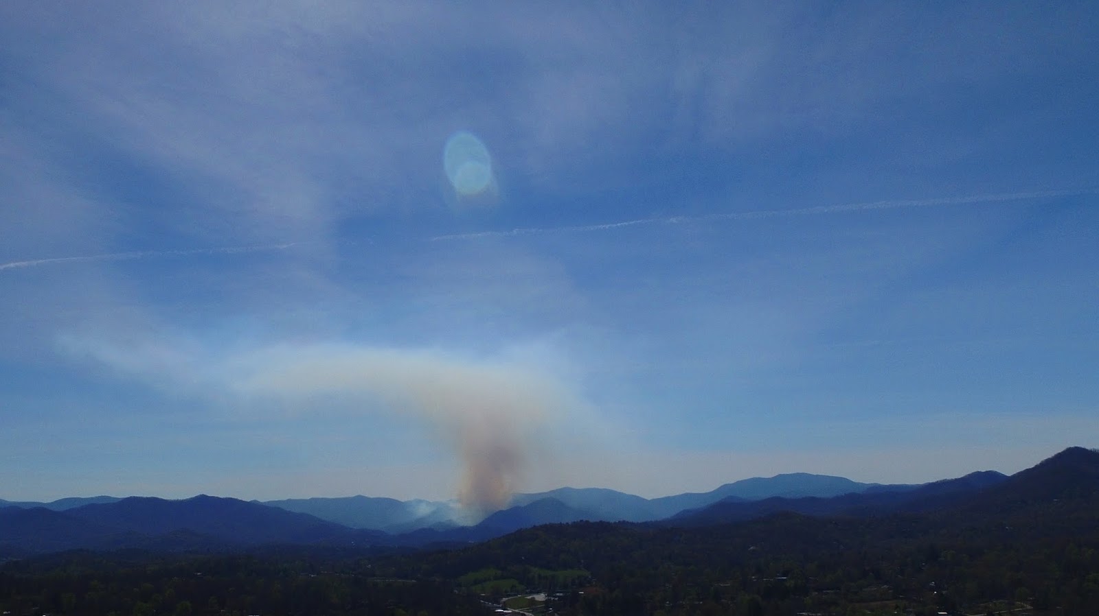
The NC Forest Service, US Forest Service and several local Volunteer Fire Departments responded to loose fires yesterday afternoon. A fire the US Forest Service is calling Muskrat #2 is currently burning close to the location where the Muskrat Fire burning last fall. The fire was last reported to be over 20 acres in rough terrain and fire lines are being put around the fire. A helicopter with a bucket assisted the firefighters yesterday. Today, two Type I helicopters and a crew of wildland firefighters are expected to join the effort.
Maps will be published when they become available.
Clarks Chapel Firefighters extinguished a fire on Eugene Road and Cullasaja Firefighters extinguished a fire in the Cullasaja Gorge that was in very rough terrain.
Please, if you have material you wish to burn outdoors, please put it off for a few more weeks.
Video of a helicopter taking off from the Macon County Airport to assist firefighters at the Muskrat #2 Fire on April 10, 2017.
LOCAL OUTLOOK
Passage of frontal system on Wednesday will produce some showers and thunderstorms with more limited chances for rain Thursday through early next week. High pressure following the cold front will produce seasonally normal to above normal temperatures and relatively light winds.
Weather Almanac for April 11th (1872-2016)
Record weather events for this date in Macon County
Highest Temperature 88°F at the Coweeta Experimental Station in 2001
Lowest Temperature 18°F at the Coweeta Experimental Station in 1960
Greatest Rainfall 3.85 inches in Highlands in 1913
Greatest Snowfall 1.3 inches in Highlands in 1956
THREE DAY OUTLOOK
TODAY (Increased fire danger, outdoor burning is not recommended)
Mostly sunny with highs near the mid 70s. Winds will be calm early, then gradually increase to 5 to 10 mpg out of the southwest in the afternoon.
TONIGHT
Increasing clouds with lows near 50 and winds shifting overnight from out of the southwest to come out of the northwest by morning.
WEDNESDAY
Mostly cloudy with highs near the mid 70s. Calm winds early, the out of the northwest by midmorning. 40% chance of rain with rainfall amounts of less than a tenth of an inch expected.
WEDNESDAY NIGHT
Partly cloudy with lows near 50 and calm winds.
THURSDAY
Mostly sunny with highs near the mid 70s.
THURSDAY NIGHT
Mostly cloudy with lows near the lower 50s.
HAZARDS
No hazardous weather is expected. There is still an increased fire danger Due to Macon County still being in a Severe Drought. Outdoor burning is not recommended. The rain that is in the forecast for Wednesday won’t even touch our situation. We will need several inches of rain over the course of weeks to recover.
As always, you can check to see what advisories, watches and warnings are in effect for Macon County by visiting http://is.gd/MACONWARN
MACON CALENDAR
If you have an event you wish to be added to this calendar, please send the information, along with a flyer in pdf format or a high quality photo, to [email protected]
There is no charge for civic, educational or non profit groups.
April 12
Bird walk along the Greenway. Meet at Big Bear Shelter parking area at 8:00 am.
APRIL 21 & 22
Franklin High School FFA Benefit Rodeo
Macon County Fairgrounds – 1436 Georgia Rd
Tickets available at the gate
$12 Adults
$6 Kids ages 5-10
Under 5 Free
Gates open at 6PM each night
Event starts at 8PM each night
Concessions available on site
Get there early for the best seating!
Saddle Bronc Riding
Bareback Riding
Calf Roping
Steer Wrestling
Ladies Breakaway Roping
Team Roping
Ladies Barrel Racing
Bull Riding
For more information, please visit the Facebook event page at https://www.facebook.com/events/1248793605202655/
SYRINGE EXCHANGE PROGRAM
On January 1, 2017, the Syringe Exchange Program of Franklin began operating a comprehensive harm reduction program to address the opioid epidemic that is effecting western NC. Opioid overdose reversal kits including naloxone are available free of charge. If you have any questions about our services or if you know someone interested in volunteering, please contact Stephanie Almeida at 828-475-1920.
Astronomy
Twilight Begins: 6:40 am
Sunrise: 7:06 am
Sunset 8:03 pm
Twilight Ends: 8:29 pm
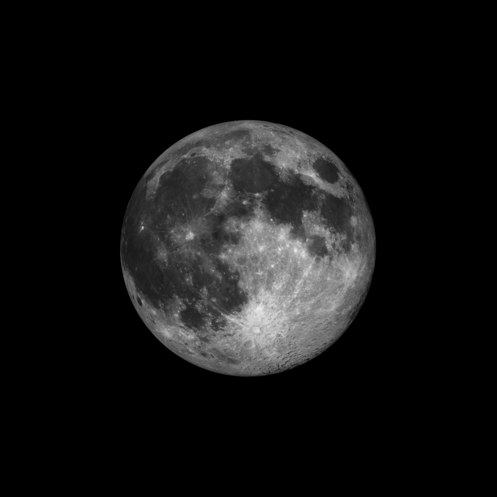
Moon Phase: Full moon occurred at 2:08 am
Moonset 7:33 am
Moonrise 8:36m
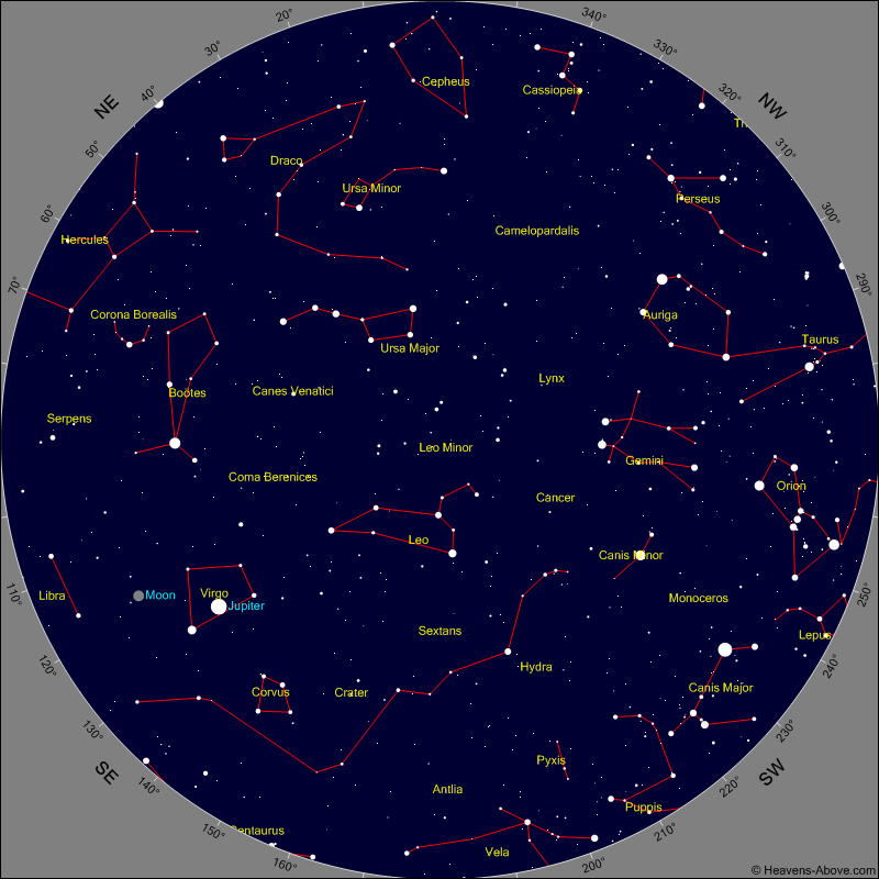
Evening Events and Planets
Chart shows sky at 10:30 pm tonight
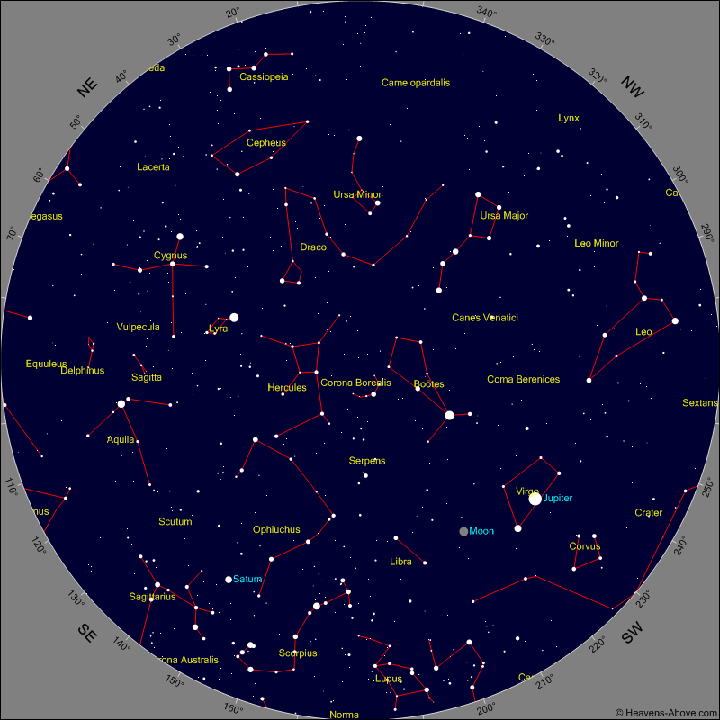
Morning Events and Planets
Chart shows sky at 4 am tomorrow morning
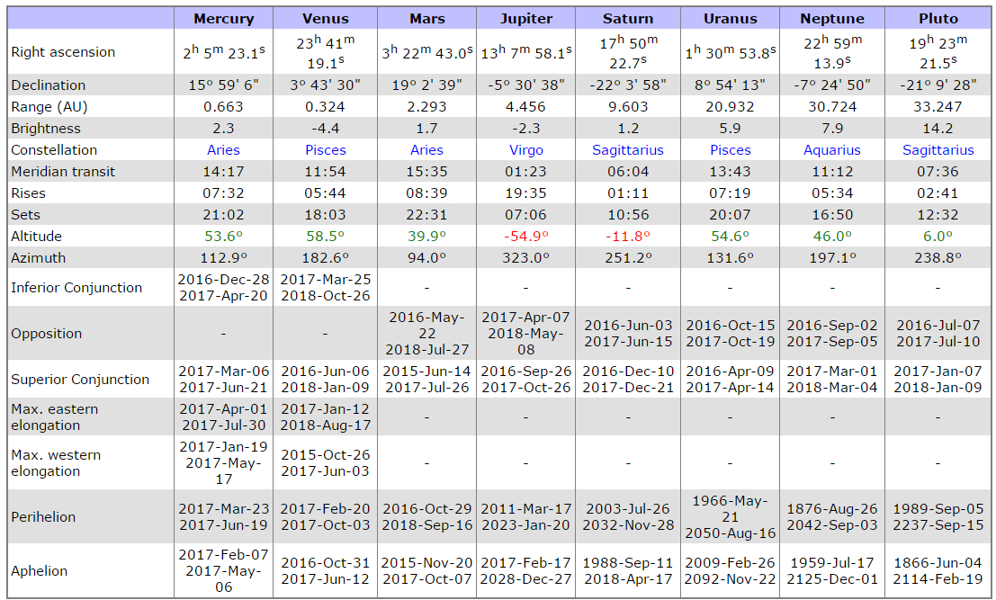
PLANET POSITION SUMMARY
Sky Guides for this week
Sky and Telescope Magazine
Astronomy Magazine
Earth Sky has an article on the eclipses of 2017. [LINK]
Heavens Above has an Android App that will assist you in observing the sky and even has a satellite tracker that will let you know when the International Space Station and dozens of other satellites are overhead. [LINK]
Stellarium is also an app that will assist you in observing the sky. It is available in both Android [LINK] and iOS versions. [LINK]
CROWD FUNDING OR DAY SPONSORSHIP OPPORTUNITIES
If you receive value from what Macon Media provides to the community, please consider becoming a supporter and contribute at least a dollar a month.
If you have a business or event you are interested in sponsorship opportunities or underwriting coverage, send an email to [email protected] for more information. Serious inquiries only.
Thank You to the people who have been sending in donations and those businesses who are underwriting coverage of news and events. You have kept Macon Media online. You have made it possible for Macon Media to begin purchasing state of the art equipment and begin work on building a real website with features not employed by any local news outlets.
You can find out more information on how to do that and some of what I plan to accomplish if I reach certain levels of funding at https://www.patreon.com/MaconMedia
Published at 4:09 am on April 11, 2017
#WNCscan #MaconWx #MaconSafety
Data and information sources: Sources (except where otherwise credited): heavens-above.com, National Centers for Environmental Prediction, The National Weather Service, National Oceanic Atmospheric Administration, Penn State University Electronic Wall Map, The State Climate Office of North Carolina, Storm Prediction Center, U.S. Naval Observatory, and the Weather Prediction Center.
Source: http://thunderpigblog.blogspot.com/2017/04/wx20170411.html


