
| Visitors Now: | |
| Total Visits: | |
| Total Stories: |

| Story Views | |
| Now: | |
| Last Hour: | |
| Last 24 Hours: | |
| Total: | |
Maplets iPhone App
For someone who used to be a huge computer nerd, these days I feel like an old fart when it comes to technology. Social networks and smart phones seem like voodoo magic to me. Popular programs and websites like Facebook and Google Earth are totally new to me in the past year or two. Things like Twitter make some sense to me, but I can’t quite understand why they’re so popular. But I try to keep up with what all the kids are up to these days.
A few weeks ago, on the Backpackinglight Northeast Regional Meet Up, I overcame my fear of spending money on the iPhone App Store and downloaded the Massachusetts State Parks Maplets app. In the past ten months that I’ve had this phone, I’ve only spent money on two apps before this one. I’m a pretty stingy person, and I don’t like to buy things without knowing exactly what I’m getting, so dropping the whopping $1 for this app made me nervous. The verdict? Even if I never use it again, it was well worth the money I spent on it.
 |
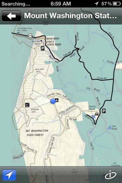
| Screen shot from the app while I was in the trailside campsite. The GPS location was spot on. |
In a way, this app is everything you want an iPhone app to be. It’s simple, effective, useful, and elegant. Come to think of it, it also represents much of the Ultralight ethic in those four traits. What you get for your 99 cents is access to maps of every state park in Massachusetts (there are other versions of this app for California, National Parks, and others), but with a twist. While you could get any of these maps for free from various state park websites, or from park visitor centers– the extra bonus here is that the free map now integrates quite nicely with the iPhone’s GPS.
The three of us driving into Mount Washington State Park on that Friday night got in late at night, so the directions we’d taken down were a little difficult to follow. Being deep in the Berkshires, we also had no data signals for our phones, so my Google Maps weren’t loading to give us directions. I’d already downloaded the state park map, though, so I switched, and we were able to use that map with the little blue dot of our GPS location to direct us to the park entrance. Later, while hiking on Mount Alander, I was able to use the GPS function and watch the compass direction pointing out from the blue dot to see where I was going on the trails, which were otherwise spottily marked.
 |
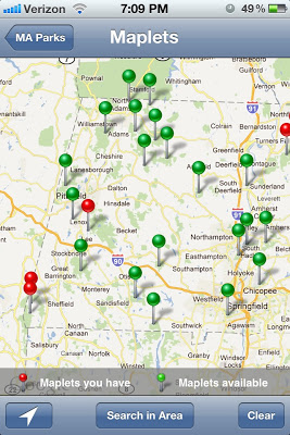
| This seems self explanatory, right? When you tap on the pins, they show which park they represent. |
Plenty of people will pooh-pooh the use of smartphones in the backcountry, but let’s face it: they’re just another tool you can use in the right situations. For occasionally checking my location on the trails, and having easy access to several maps of an area, a simple app like this is a perfect example of simplicity and functionality.
Disclaimer: I paid real money for this product, and the review is unsolicited by the developers of the app.
Guthook (aka Ryan) is an ultralight long-distance backpacker. He has hiked the Appalachian Trail, the Pacific Crest Trail, the Trans-New England Trail, and more. Read more about destinations, gear, and lightweight backpacking at http://guthook.blogspot.com
Source:


