


| Story Views | |
| Now: | |
| Last Hour: | |
| Last 24 Hours: | |
| Total: | |
The Urban Sasquatch Journal: Shocking Find!

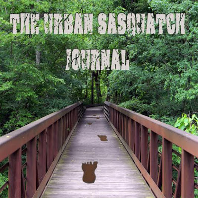
This is the reporting by a Bigfoot researcher of an ongoing study in the Southern part of the United States in a very large park area near homes and urban setting.
#3 “The Urban Study Begins”
#4 “Signatures and Signs”
#5 “Mixing It Up”
#6 “Neglected and Discouraged”
#7 “Adding Complexities”
#8 ”Stunning Interactions”
#9 “Showing My Intent”
#10 ”I'm Being Directed”
#11 ”New Team Member”
#12 ”Working It Vigorously“
#13 “Curious Interactions”
#14 “New Season Begins”
#15 “Answering My Thoughts?”
#16 Trail Cam Sham
#17 Training for Cameras
#21 Research Considerations
#22 Making Signs
#23 Footprint Found
#24 Testing Animal Versus Sasquatch
#25 Enticing With Food and Curiosity
#26 Amping up the Exchange
#27 Opening Communication
#28 Extended Visit
#29 Pillaged and Moved
#30 Feather Gift
#31 Disarray
#32 Evolving
#32 Flooding and Chaos
#33 After the Floods
#34 Lots of Changes
#35 Hair Samples
#36 Lots of Tinkering
I took 32 photos during this field visit. They will be posted with my explanations.
During the week, I was aware that major storms would be hitting this area Saturday and Sunday. The rains from the hurricane pounding the west coast of Mexico would hit us over the weekend.
I believe the next item is important for this visit. For this week, I have put out a lot of thoughts of my going to the sites this Friday. Again, this is due to the storms coming.
then headed to the east end of the trail. I was heading to the P.R.O.W. first.
I decided to do something different. I wear a camo vest on all my field visits, attached to the zipper is my survival whistle. While biking on the trail to the east past the bridge, at approximately 1/4 mile intervals, I would blow on the whistle in a particular fashion. This could be heard much farther than my pitiful close-up whistling. I would blow towards the south while biking. Since I consider their hearing much better than mine, I figure those knowing I use this whistle would be alerted that 'the funny, busy guy' is now in the area. After this, I also began to blow it when arriving at site 1B, along with my other signature routines.
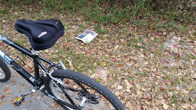
Okay, now to the item that nearly caused me to fall off my bike. As I rode past the P.R.O.W. I did a whistle back to the south and kept going. I would soon be at the end of the trail, turn around heading back to the P.R.O.W. I rode approximately another 1/4 mile+ when something on the ground on the south side of the trail caught my attention.
#1. thru #3.
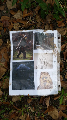
Remember, my last visit to the P.R.O.W., I hung a montage of 'BF' drawings on the rear side of a tree? The drawings were taped on both sides of copier paper put into a laminate cover holder. I had also taped across the top opening and stapled across the top to keep it from being taken out of the cover. I took this and hung it on a nail. It could not be seen from the P.R.O.W. , only from the east side woods, across the immediate area to the P.R.O.W.
This is what blew me away. I saw this laminate cover sheet with drawings now on the ground just a few feet off the south side of the paved trail. HOW DID IT GET HERE???? I was stunned! From this point back to the site from my line of travel is approximately 1/2 mile. South of the trail to the site through the woods could be 1/4 mile or less. My thoughts on this follows:
I didn't know what to think. I called a researcher friend right then and shared what I saw. He also was baffled. One suggestion was maybe, 'FP' was over in the woods watching to see what I would do. I don't know?? Is this 'Messing with the funny human?' This is certainly something I experienced many years ago hundreds of miles from here. I carefully with gloves, I put the cover into a plastic bag then into my back pack. I will hung it again but not till another visit. I complete my ride to the end of the trail then return to the P.R.O.W.
At 3:12 PM, I stopped at the P.R.O.W., got my binoculars out and observed to the south. No activity was noted. I then moved on to the first entry on the east side. Nothing seemed out of place from the last set-up. I move on to the 2nd P.R.O.W. site. Note the following from photos taken:
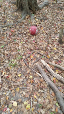
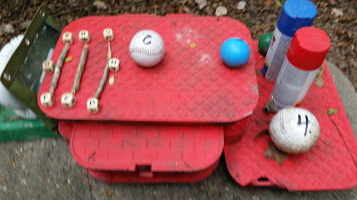
#4. and #5. Both photos show the red 'face' ball moved from the square in front of the ground direction pointer limbs.

#6. On the left side of the horizontal limb on the main set-up, 3 marbles are missing.
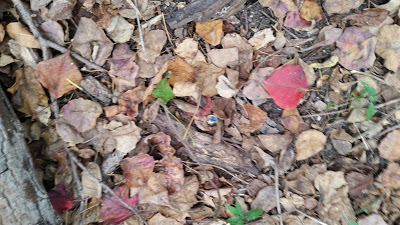
#7. Near the base of the set-up, a marble was seen among the ground clutter. This was one of the marbles from the horizontal limb.
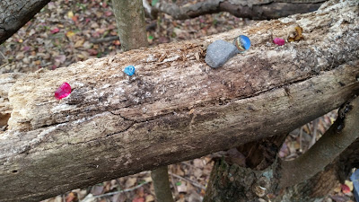
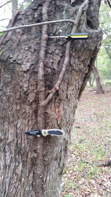
#8. This is where the laminated cover sheet of drawings was located. The nail can be seen approximately 12″ above the knife being gifted.

#9. Shows the knife again with nail above and a Phillips screwdriver as another gift.
#10. and #11. Here is the main set-up . I put the red ball on-top and added the garbage can lid at the bottom. In the 2nd photo zoomed in, there is the ancient native American drawings laminated cover sheet. It was still intact at this time.
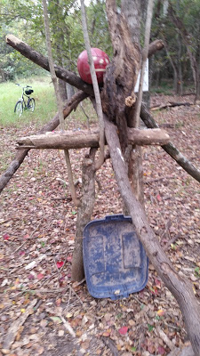

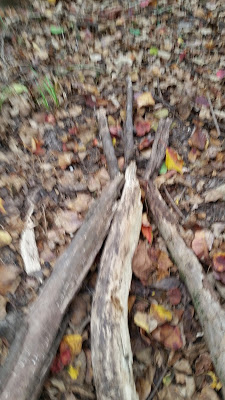
#12. Here is the ground arrow direction pointer. I added the 3 small pieces of limbs at the point.
I noted another odd occurrence at this spot. Approximately 3 trees to the east from the knife gifting tree, a piece of pink marking tape was tied to the tree approximately 7' off the ground. Initially, I thought another person may have put this up. If someone like me did put it up, that person passed on taking the pocket knife. It is in full view from the tree which had the pink marking tape. Well, I did not consider all this at first. I pulled it off the tree and put it in my back pack to get rid of later. I did not take a photo of it on the tree. The photo I did take was after getting to my vehicle before leaving the parking lot.
#32.

Here is my far out theory on what took place. At site 1B, I have put up yellow caution tape as a boundary or limitation as to how far back to the North and East I will explore from sites 1A and 1B. 1A is bordered by the main creek on the South side and 1B to the North. The 'FP' probably saw me putting the caution tape up and if understand my meaning know it's a boundary matter. Not for them to stay out but from my mind, for me to have a limit of movement in their domain. When I consider the pink tape, I now think I was being told to not go past this tree on towards the east. To stop at this spot. This is not just mimicking what they or one observed of me but with knowledge and purpose. The same with the cover sheet off the trail of my passing by.
Time to moved on. At 3:45 PM, I rode on to site 1B. Got there and made the following observations and also did fresh set-ups.
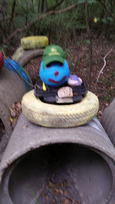
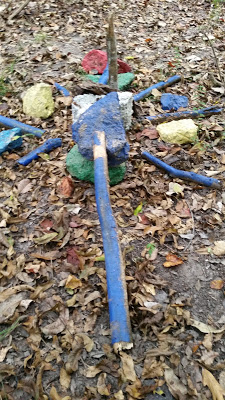
#13. At the rock circle, the large, blue rock has been moved.??? The long limb next to the white, green and blue rocks is now on the ground off those rocks. The last visit, the limb was on the rocks with the blue painted side up. It was on the ground with the natural side up.????
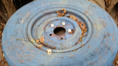
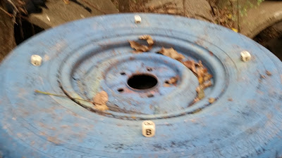
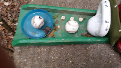
#14. One of the scrabble letter's dice was moved from the rim onto the tire itself at the rim edge away from the other 3 dice. ????
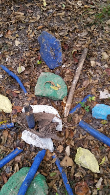
#15. The items on the red water meter cover have been moved slightly. ???? In the far left corner, a small stick has been added to the set-up. ????
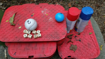
#16. In the green plastic set-up, the 3 letter dice have been moved around slightly, a short stick is next to the kettle bell. On the pipe, 2 short sticks have been added. ????
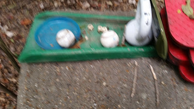
#17. One ball is on the ground near the pipe. Also the 2 short sticks can be seen again. ????
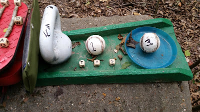
#18. This ball is the #4 softball. ????
#19. The baseball, the letters dice, the markers zippered case have all been moved.???
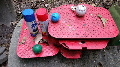
#20. The opposite side of the green plastic set-up. the 3 letters dice are out of alignment. The stick is clearly seen next to the kettle bell. The zippered marker case is clearly seen between the kettle bell and the red water meter covers. ?????

#21. thru #26. and #28 and #29. All new set-ups at the pipes.


#27. New set-up at the rock circle.
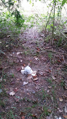
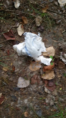
#30. and #31. At the entry area of site 1B, some fast food garbage. This was not brought in by flooding. it looks as if recently been eaten.????
This visit went well beyond my expectations. An awesome time! A highlight field visit; however, as usual, I don't know what to think. I will continue to press on and see what follows. Will I ever get the visual I seek???
Maybe in time.
This concludes field report #32 for Friday Oct. 23 2015.
Source: http://www.ghosthuntingtheories.com/2016/01/the-urban-sasquatch-journal-shocking.html
