


| Story Views | |
| Now: | |
| Last Hour: | |
| Last 24 Hours: | |
| Total: | |
Tens of Millions of Trees in Danger from California Drought

In addition to the persistently low rainfall, high temperatures and outbreaks of the destructive bark beetle increased forest mortality risk. But gaining a large-scale understanding a forest’s responses to the drought, as well as to ongoing changes in climate, required more than just a picture of trees that have already died.
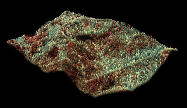
Courtesy of Greg Asner.
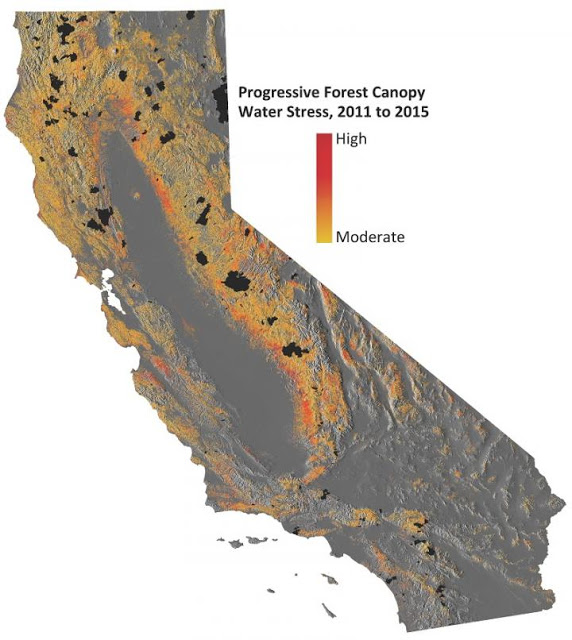
Their new approach revealed a progressive loss of water in California’s forest canopies over the four-year span. Mapping changes in canopy water content tells scientists when trees are under drought stress and greatly aids in predicting which trees are at greatest death and fire risk.
“California relies on its forests for water provisioning and carbon storage, as well as timber products, tourism, and recreation, so they are tremendously important ecologically, economically, and culturally,” Asner explained. “The drought put the forests in tremendous peril, a situation that may cause long-term changes in ecosystems that could impact animal habitats and biodiversity.”
The team’s advanced tools showed that about 41,000 square miles (10.6 million hectares) of forest containing up to 888 million large trees experienced measurable losses of canopy water between 2011 and 2015. Of this group, up to 58 million large trees reached water loss thresholds that the scientists deemed extremely threatening to long-term forest health. Given the severity of the situation, even with increased precipitation due to El Nino, if drought conditions reoccur in the near future, the team predicts that there would be substantial changes to already significantly weakened forest structures and systems.
Since day one of CAO flight operations, Asner has been engaged with forest managers and officials from the California EPA and Department of Forestry and Fire Protection to inform decision-makers on the severity of forest water losses from the drought and beetle outbreaks. The team’s results also helped motivate the California governor’s recent proclamation of a state of emergency for dead and dying trees across the state. The latest CAO maps of forest vulnerability were recently transmitted to both state and federal partners.
“Our high-resolution mapping approach identifies vulnerable trees and changing landscapes,” Asner added. “Continued airborne and satellite monitoring will enable actions on the ground to mitigate a cascade of negative impacts from forest losses due to drought, as well as aid in monitoring forest recovery if and when the drought subsides.”
Contacts and sources:
The Carnegie Institution for Science
Source: http://www.ineffableisland.com/2015/12/tens-of-millions-of-trees-in-danger.html
