

| Online: | |
| Visits: | |
| Stories: |

| Story Views | |
| Now: | |
| Last Hour: | |
| Last 24 Hours: | |
| Total: | |
The Geography of Antarctica’s Underside: Seismic Maps of the Mantle Will Improve Predictions of Giant Ice Sheet’s Fate

The topography of West Antarctica below the ice sheet as viewed from above, looking toward the Antarctic Peninsula. Much of West Antarctica is a basin that lies below sea level (blue), although it is currently filled with ice, not water. West Antarctica was stretched and thinned as it moved away from East Antarctica, forming one of the world’s largest continental rift systems.

“Our understanding of what’s going on is really hampered because we can’t see the geology,” said Andrew Lloyd, a graduate student in earth and planetary sciences in Arts & Sciences at Washington University in St. Louis. “We have to turn to geophysical methods, such as seismology, to learn more,” he said.
Credit: Mike Roberts
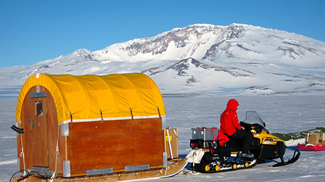
Lloyd helped deploy research seismometers across the West Antarctic Rift System and Marie Byrd Land in the austral summer of 2009-10. He then returned in late 2011 and snowmobiled more than 1,000 miles, living in a Scott tent, to recover the precious data.
The recordings the instruments made of the reverberations of distant earthquakes from January 2010 to January 2012 were used to create maps of seismic velocities beneath the rift valley. An analysis of the maps was published online in the Journal of Geophysical Research: Solid Earth on Nov. 12, 2015 (doi:10.1002/2015JB012455).
This is the first time seismologists have been able to deploy instruments rugged enough to survive a winter in this part of the frozen continent, and so this is the first detailed look at the Earth beneath this region.
Not surprisingly, the maps show a giant blob of superheated rock about 60 miles beneath Mount Sidley, the last of a chain of volcanic mountains in Marie Byrd Land at one end of the transect. More surprisingly, they reveal hot rock beneath the Bentley Subglacial Trench, a deep basin at the other end of the transect.
The Bentley Subglacial Trench is part of the West Antarctic Rift System and hot rock beneath the region indicates that this part of the rift system was active quite recently.
A volcanic mystery
Mount Sidley, the highest volcano in Antarctica, sits directly above a hot region in the mantle, Lloyd said. Mount Sidley is the southernmost mountain in a volcanic mountain range in Marie Byrd Land, a mountainous region dotted with volcanoes near the coast of West Antarctica.
“A line of volcanoes hints there might be a hidden mantle plume, like a blowtorch, beneath the plate,” said Doug Wiens, PhD, professor of earth and planetary sciences and a co-author on the paper. “The volcanoes would pop up in a row as the plate moved over it.”
“But it’s a bit unclear if this is happening here,” he said. We think we know which direction the plate is moving, but the volcanic chain is going in a different direction and two additional nearby volcanic chains are oriented in yet other directions.
“If this was just a plate moving over a couple of mantle plumes, you’d expect them to line up, as they do in the Hawaiian Islands,” he said.
Although the hot zone’s shape is ill-defined, it is clear there is higher heat flow into the base of the ice sheet in this area, Wiens said.
Deeper than the Grand Canyon
The most interesting finding, Lloyd said, is the discovery of a hot zone beneath the Bentley Subglacial Trench.
The basin is part of the West Antarctic Rift System, a series of rifts, adjacent to the Transantarctic Mountains, along which the continent was stretched and thinned.

Credit; Washington University in St. Louis
Immerse yourself in the element!
Listen to Doug Wiens describing what it’s like to do research in Antarctica: Hold that Thought
Watch one day in the life of Andrew Lloyd as he deploys seismometers in Antarctica.
Credit: Washington University in St. Louis
The old rock of East Antarctica rises well above sea level, but west of the Transantarctic Mountains, extension has pulled the crust into a broad saddle, or rift valley, much of which lies a kilometer below sea level.
“If you removed the ice, West Antarctica would rebound, and most of it would be near sea level. But the narrower and deeper basins might remain below it,” Lloyd said. “The Bentley Subglacial Trench, which is the lowest point on Earth not covered by an ocean, would still be a kilometer and a half below sea level if the ice were removed.”
Because the West Antarctic Rift is hidden, less is known about it than about other famous rift systems such as the East African Rift or, in the United States, the Rio Grande Rift.
“We didn’t know what we’d find beneath the basin,” Wiens said. “For all we knew it would be old and cold.
“We didn’t detect any earthquakes, so we don’t think the rift is currently active, but the heat suggests rifting stopped quite recently.”
In this way, it resembles the Rio Grande Rift, which is also no longer active but has yet to cool completely.
A period of diffuse extension created the rift valley in the late Cretaceous, roughly 100 million years ago, Lloyd said, and more focused extension then created deep basins like the Bentley Subglacial Basin and the Terror Rift in the Ross Sea.
“This period of more focused extension likely occurred in the Neogene,” Lloyd said. “If it’s still hot there, it might also be hot under other basins in the rift system.”
Will the heat flow grease the skids?
“But to accurately model how quickly the ice is going to flow or the rock to rebound, we need to understand the ‘boundary conditions’ for ice models, such as heat flow from the mantle,” he said.
“Seismic surveys like this one will help inform models of the ice sheet,” Wiens said. “Modelers need an estimate of the heat flow, and they need to know something about the geological conditions at the bottom of the ice sheet in order to estimate drag. Right now, both of these factors are very poorly constrained.”
While heat flow through the Earth’s crust has been measured at at least 34,000 different spots around the globe, in Antarctica it has been measured in less than a dozen places. In July 2015, scientists reported the heat flow at one of these spots was four times higher than the global average.
Ever since then, scientists have been wondering why the reading was so high. “Recent extension in the Bentley Subglacial Trench might explain these readings,” Wiens said.

Credit: Mike Roberts
The next big problem, he said, is to understand the structure under the Thwaites and Pine Island glaciers, which lie closer to the coastline than the Bentley Subglacial Trench. These two glaciers have been described as the ‘weak underbelly’ of the ice sheet because surges in the ice flow there could theoretically cause the rapid disintegration of the entire West Antarctic ice sheet.
During the 2014-2015 Antarctic field season, Lloyd helped deploy another 10 seismic stations that together with seismometers deployed by the British will map the underside of this key area.
Contacts and sources:
Source: http://www.ineffableisland.com/2015/12/the-geography-of-antarcticas-underside.html
