

| Online: | |
| Visits: | |
| Stories: |

| Story Views | |
| Now: | |
| Last Hour: | |
| Last 24 Hours: | |
| Total: | |
Zoom to the Moon’s North Pole with this Incredible New Gigapixel Map

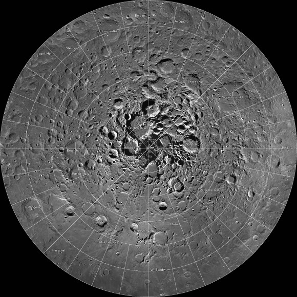
A new interactive mosaic from NASA’s Lunar Reconnaissance Orbiter covers the north pole of the moon from 60 to 90 degrees north latitude at a resolution of 6-1/2 feet (2 meters) per pixel. Click to go to the interactive map. Credit: NASA/GSFC/Arizona State University
OMG – breathtaking! That was my reaction when I clicked on this incredible new interactive map of the moon’s north polar region. Be prepared to be amazed. It took four years and 10,581 images for the LROC (Lunar Reconnaissance Orbiter Camera) team to assemble what’s believed to be the largest publicly available image mosaic in existence. With over 650 gigapixels of data at a resolution of 2 meters per pixel, you’ll feel like you’re dropping in by parachute to the lunar surface. (…)
Read the rest of Zoom to the Moon’s North Pole with this Incredible New Gigapixel Map (358 words)
© Bob King for Universe Today, 2014. |
Permalink |
No comment |
Post tags: LRO, LROC, Moon, north pole
Feed enhanced by Better Feed from Ozh
Source: http://www.universetoday.com/110433/zoom-to-the-moons-north-pole-with-this-incredible-new-gigapixel-map/
