| Online: | |
| Visits: | |
| Stories: |

| Story Views | |
| Now: | |
| Last Hour: | |
| Last 24 Hours: | |
| Total: | |
The Waters Of Mars: New Map Shows Something Unexpected

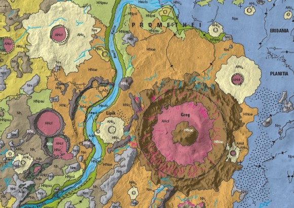
A portion of a 2014 Mars map showing the area east of Hellas basin, at midsoutherly latitudes. Credit: USGS
Where did the water on Mars come from, and where did it go? This plot (sort of) formed the basis of one of the best Doctor Who episodes of the modern era, but in all seriousness, it is also driving scientists to examine the Red Planet over and over again.
This means revisiting older information with newer data to see if everything still matches up. From time to time, it doesn’t. The latest example came when scientists at the U.S. Geological Survey created a map of the canyon systems of Waikato Vallis and Reull Vallis, which are in the midsoutherly latitudes of Mars.
They previously believed the canyons were connected, but updating the data from an understanding based on 1980s Viking data revealed a different story.
(…)
Read the rest of The Waters Of Mars: New Map Shows Something Unexpected (229 words)
© Elizabeth Howell for Universe Today, 2014. |
Permalink |
No comment |
Post tags: Reull Vallis, united states geological survey, Waikato Vallis, Water on Mars
Feed enhanced by Better Feed from Ozh
Source: http://www.universetoday.com/113057/the-waters-of-mars-new-map-shows-something-unexpected/


