| Online: | |
| Visits: | |
| Stories: |

| Story Views | |
| Now: | |
| Last Hour: | |
| Last 24 Hours: | |
| Total: | |
New Map Shows ‘Marsquakes’ Shook Wet Valles Marineris Sand, NASA Says

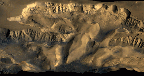
A color mosaic of Candor Chasma (part of Mars’ Valles Marineris) based on data from Voyager 1 and Voyager 2. Credit: NASA
Mars today is a planet that appears to be mostly shaped by wind, but that wasn’t always the case. A new map adds information to the hypothesis that “marsquakes” affected at least a part of the planet’s vast canyon, Valles Marineris, while the area contained spring-filled lakes.
When the damp sand got shaken up, it deposited itself in hills. NASA says the new map, based on observations from the Mars Reconnaissance Orbiter (which you can see below), adds credence to the theory that it was water that made these deposits.
(…)
Read the rest of New Map Shows ‘Marsquakes’ Shook Wet Valles Marineris Sand, NASA Says (140 words)
© Elizabeth Howell for Universe Today, 2014. |
Permalink |
No comment |
Post tags: High Resolution Imaging Science Experiment (HiRISE), mars reconnaissance orbiter, u.s. geological survey, valles marineris
Feed enhanced by Better Feed from Ozh
Source: http://www.universetoday.com/117286/new-map-shows-marsquakes-shook-wet-valles-marineris-sand-nasa-says/


