


| Visitors Now: | |
| Total Visits: | |
| Total Stories: |

| Story Views | |
| Now: | |
| Last Hour: | |
| Last 24 Hours: | |
| Total: | |
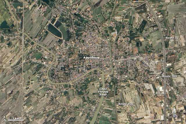
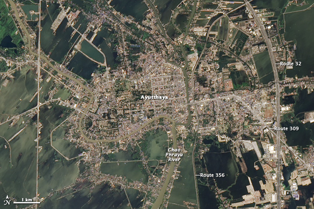
Image of the Day: Satellite View of Receding Floodwaters around Ayutthaya, Thailand, 9 January 2011

Ayutthaya, Thailand, 9 January 2011
Ayutthaya, Thailand, 1 December 2011
Caption by Michon Scott
9 January 2012Flood waters continued receding in Thailand’s historic city of Ayutthaya in December 2011 and January 2012. The Advanced Land Imager (ALI) on NASA’s Earth Observing-1 (EO-1) satellite captured the top image on 9 January 2012, and the bottom image on 1 December 2011.
In December 2011, dark brown-green floodwater surrounds the city, obscuring boundaries between agricultural fields. In January, the patchwork of fields has emerged, especially south of the city. Although considerably more flooded than in January, Ayutthaya does show better conditions in December 2011 than in November, when the city was just starting to dry out.
Located along the banks of the Chao Phraya River north of Bangkok, Ayutthaya is a United Nations Educational, Scientific and Cultural Organization (UNESCO) World Heritage site. The city was founded in the fourteenth century, and is now attracts many tourists.
References
World Heritage. (2011). Historic City of Ayutthaya. UNESCO. Accessed 13 January 2012.
Read more at Desdemona Despair
Source:
