


| Visitors Now: | |
| Total Visits: | |
| Total Stories: |

| Story Views | |
| Now: | |
| Last Hour: | |
| Last 24 Hours: | |
| Total: | |
Gulf Spill – Not So Fast – Problem at LOOP?
Wednesday, March 23, 2011 14:39
% of readers think this story is Fact. Add your two cents.

Whoa, hold the horses. Maybe Anglo-Suisse did happen to have a small spill over the weekend. But we just looked at this NASA/MODIS satellite image taken yesterday afternoon, from the Terra satellite. It shows what appears to be an extensive oil slick emanating from very near the location of the Lousiana Offshore Oil Port (LOOP). We have no confirmation of any problem at or near LOOP at this time (10:30am ET):
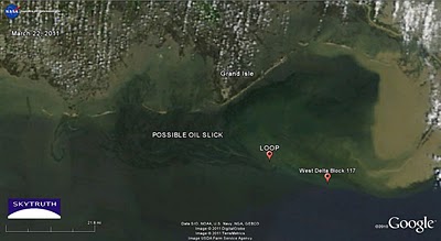 MODIS/Terra satellite image, March 22, 2011 showing possible oil slick originating near LOOP facility
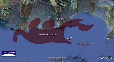 SkyTruth analysis of March 22 MODIS image showing extent of possible oil slick
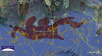 SkyTruth analysis overlain with platform locations (orange dots) and pipelines (yellow); data from BOEMRE
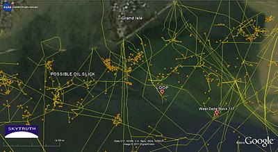 Detail of March 22 satellite image, with platform locations and pipelines