

| Online: | |
| Visits: | |
| Stories: |

| Story Views | |
| Now: | |
| Last Hour: | |
| Last 24 Hours: | |
| Total: | |
Mining in Wisconsin – Another Consequence of Fracking

How is mining related to fracking?
Well, the process of hydraulic fracturing forces fluid into the rock at extremely high pressure. This pries open natural pre-existing cracks (fractures) in the bedrock, and also causes new cracks (induced fractures) to form. This network of enhanced and induced fractures is what allows gas and oil to flow out of the rock and into the well. To keep these fractures from snapping shut when the fracking operation is completed and the pressure is eased, you need to prop them open with something. That’s why fracking fluid – a highly engineered fluid that is mostly water by volume, but can contain dozens of different chemicals – always includes a “proppant.” The drilling industry has developed manufactured proppants, but often the proppant of choice is a clean, consistent, well-rounded, tough, fine-grained sand. A typical fracking operation in the Eagle Ford Shale in Texas, for example, can use 4 million pounds or more of sand.
Where is all the sand coming from? As you might expect, Texas is one place where sand-mining is booming. But surprisingly , most of this sand comes from a place more famously associated with beer and brauts: Wisconsin. The rapid proliferation of sand-mining operations is getting a lot of attention there and raising concerns about public health and safety, property values, quality of life, and environmental impacts.
Responding to these concerns, the Wisconsin Department of Natural Resources (DNR) just published an interactive map showing the locations of all the facilities, active and inactive, involved in the mining and processing of sand in that state. Their map doesn’t have imagery, so you can’t actually “see” any of these mining operations. But when we asked, the DNR promptly gave us the facilities data (updated as of May 1, 2014), so we could make our own map using Google Maps Engine:
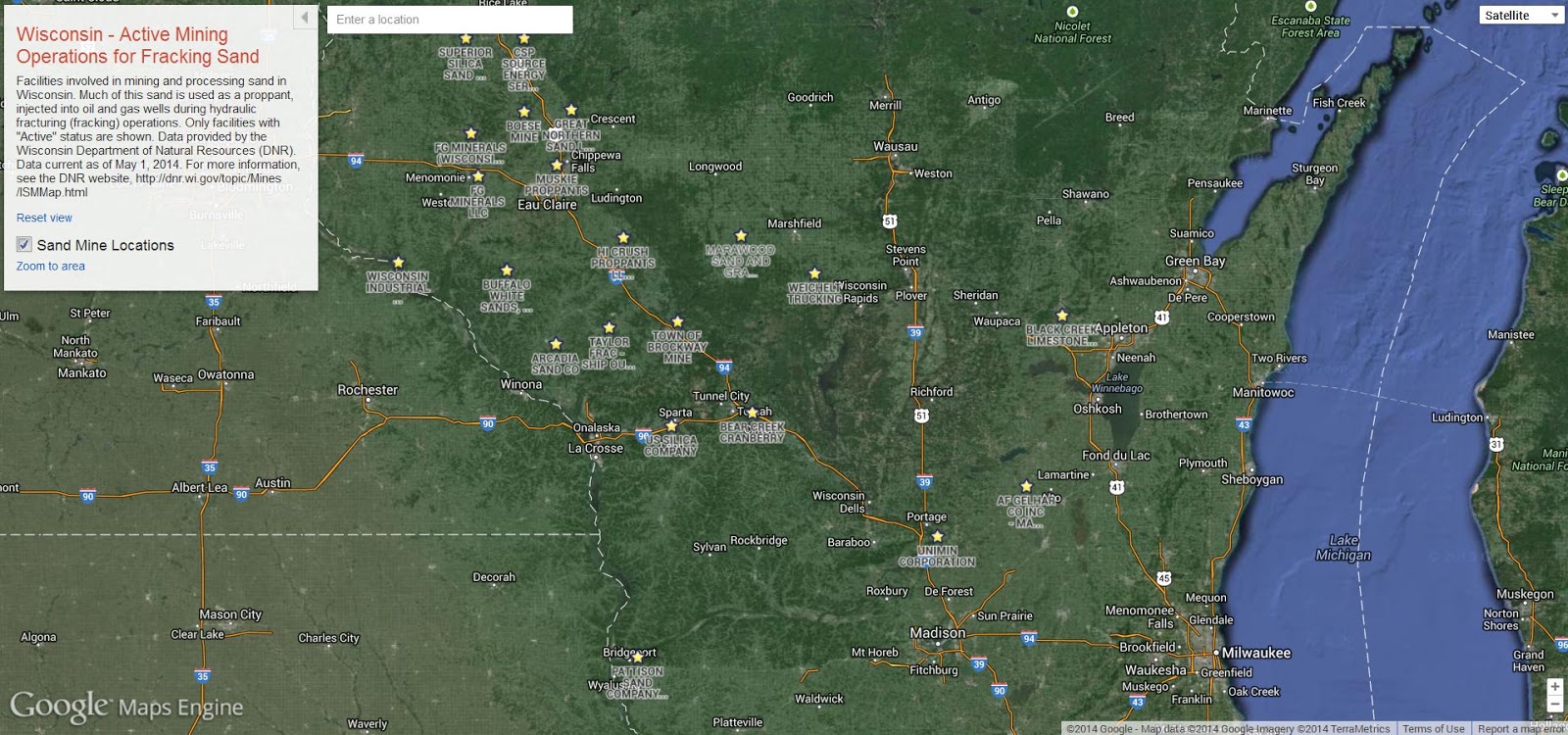 |
| SkyTruth interactive map of active Wisconsin sand mining and processing facilities, as of May 1, 2014. Data from Wisconsin Department of Natural Resource. |
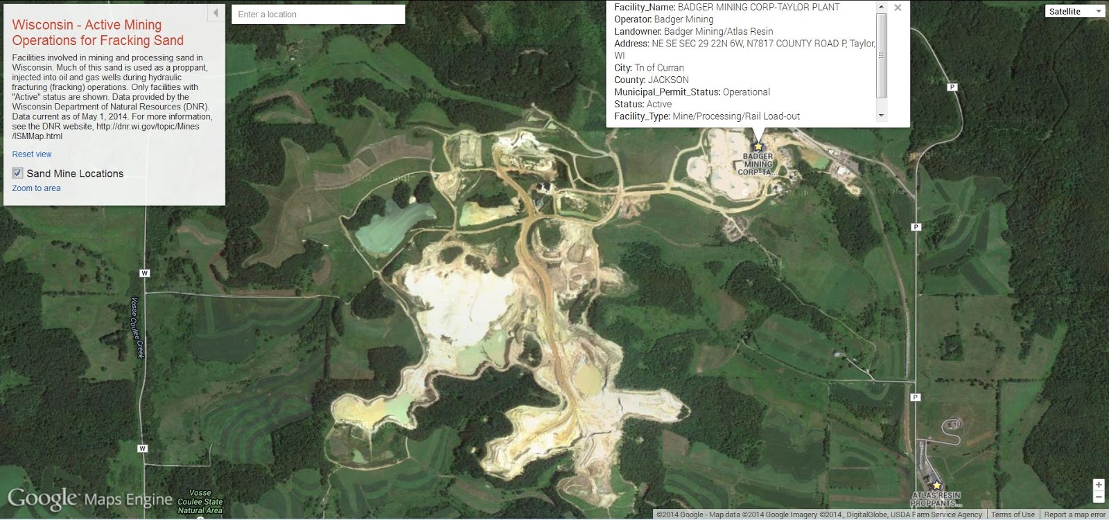 |
| Detail from map. Click on the marker to get a popup box with more information about that facility. |
Voila! Here is our map of the Wisconsin frac-sand operations. We decided to only include “active” facilities on this map. Now you can explore and zoom in on any facility, and see the latest high-resolution imagery available through Google (July 2011 in the example shown above).
Source: http://blog.skytruth.org/2014/08/mining-in-wisconsin-another-consequence.html
