(Before It's News)
Ten days ago, a big Russian fishing trawler, the Oleg Naydenov, caught on fire in port in the Canary Islands. Spanish authorities had the burning vessel towed out to sea, where it sank in water nearly two miles deep about 15 miles south of the island of Gran Canaria.
 |
| Map showing the strange final voyage of the Oleg Naydenov as it was towed, in flames, from port and taken out to sea. |
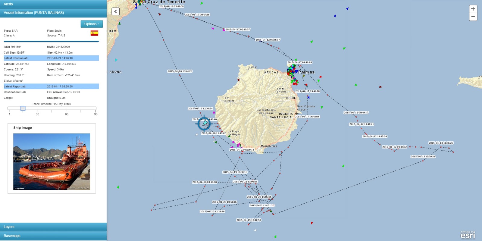 |
| Our tracking map showing the path of the vessel that did the towing. AIS data copyright exactEarth/ShipView. |
As predicted, fuel-oil is leaking from the sunken trawler and is reportedly coming ashore on some of the tourist-haven beaches. We’re curious because the slick we see very faintly on satellite images from April 21 and 23 clearly shows the oil moving to the south, away from the islands. The cloud patterns and wind-shadow indicate very strong winds blowing to the south, which would tend to push the oil in that direction. So it’s a bit of a mystery to us where the oil is coming from, that is washing ashore now on Gran Canaria. Check out the sequence of images below.
This vessel has a back story. In early 2012 it was busted for fishing illegally in the waters off Senegal, apparently multiple times, after a dogged pursuit by Greenpeace. So this oil spill could be considered part of the “collateral damage” of IUU fishing activity.
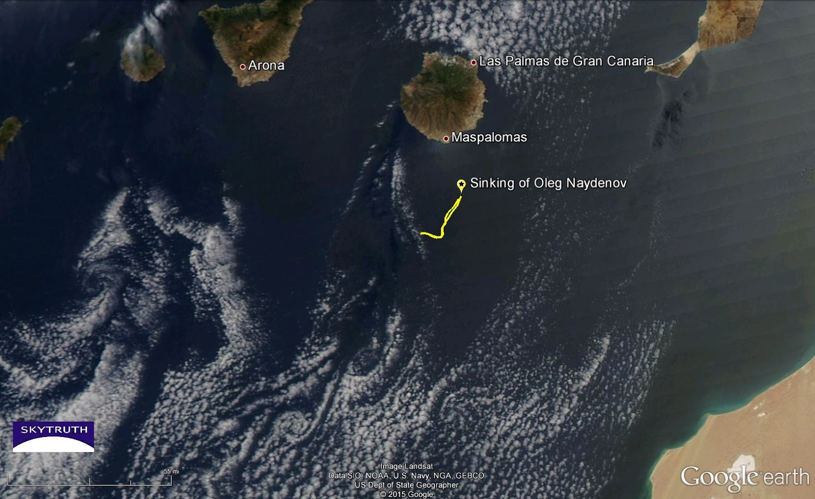 |
| MODIS satellite image taken April 23, 2015, showing the southern Canary Islands, location of the sunken trawler Oleg Naydenov, and oil slicks (yellow) detected on satellite imagery from April 21 and 23. Coast of Africa at lower right. Note spiral-shaped cloud patterns indicating Karman vortices forming downwind of the islands, suggesting strong wind blowing from the north-northeast. The “J” shape of the slicks suggests they may be affected by a Karman vortex.. |
 |
| Detail from MODIS satellite image taken April 21, 2015. Slick appears as a bright streak trailing to the south-southwest away from the site of the sunken trawler. Clouds (and shadows) at lower left. |
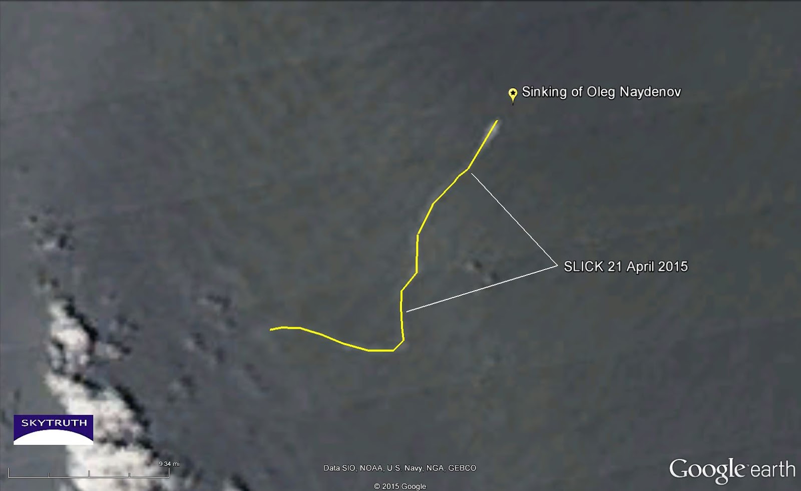 |
| Same image as above, with slick highlighted in yellow. |
 |
| Detail from MODIS satellite image taken April 23, 2015. Same area and scale as detail images above. Slick appears as faint dark feature in this image, due to different sunglint geometry than in the April 21 image. |
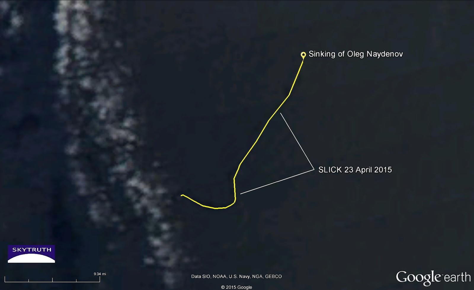 |
| Same image as above, with slick highlighted in yellow. |

Source:
http://blog.skytruth.org/2015/04/the-strange-saga-of-oleg-naydenov.html


