Online:
Visits:
Stories:
Profile image
Story Views

Now:
Last Hour:
Last 24 Hours:
Total:

Maps of the Ancient Sea Kings: Stone Atlas of the Atlas

Saturday, February 1, 2014 22:56
% of readers think this story is Fact. Add your two cents.

(Before It's News)

Posted on Facebook by Ferruh Ülker 9 hours ago (2/1/2014 3 PM EST) · Edited
10000 years old-in Algeria and my comment …(big screen) ! —

It was Ferruh's deduction that this rather famous 'Bubalus'-period rock art engraving from Algeria was a map of the Orient in disguise:
B4INREMOTE-aHR0cDovLzIuYnAuYmxvZ3Nwb3QuY29tLy0tVFVsX3JzbHhnNC9VdTJ2TUViN3pFSS9BQUFBQUFBQXhsNC9HVng1SW9NY0F0cy9zMTYwMC85OTg1NTRfNzIxOTEzMjk3ODMyNDEyXzE4MDIyMjg5MTZfbi5qcGc=

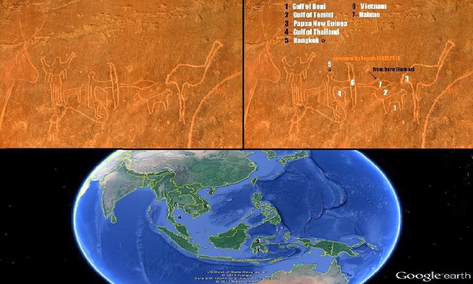
To which I added a comment: “The Ostrich's neck is also New Britain on the East end of PNG. Very clever deduction here! I shall post this on my blog ASAP”

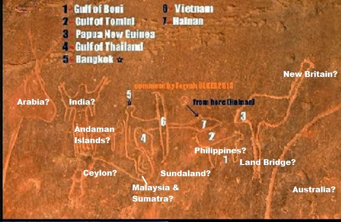
And I then made this amended version:

B4INREMOTE-aHR0cDovLzQuYnAuYmxvZ3Nwb3QuY29tLy1paWlMSUpweEVRcy9VdTJ2UDJJV1FZSS9BQUFBQUFBQXhtQS9Gci05N195aUJzYy9zMTYwMC85OTg1NTRfNzIxOTEzMjk3ODMyNDEyXzE4MDIyMjg5MTZfbjIuanBn

B4INREMOTE-aHR0cDovLzMuYnAuYmxvZ3Nwb3QuY29tLy1sa0huM1k5bHZvZy9VdTNZR1ZJamFSSS9BQUFBQUFBQXhuby9kY1BnVk5aT2Q4Zy9zMTYwMC85OTg1NTRfNzIxOTEzMjk3ODMyNDEyXzE4MDIyMjg5MTZfbjMuanBn

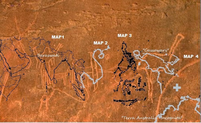
This breaks down to including four lesser regional maps, stitched together as shown above

And this means also that the Saharan rock art “Maps of the Ancient Sea Kings”

Source: http://frontiers-of-anthropology.blogspot.com/2014/02/maps-of-ancient-sea-kings-stone-atlas.html

Report abuse

Comments

Your Comments
Question   Razz  Sad   Evil  Exclaim  Smile  Redface  Biggrin  Surprised  Eek   Confused   Cool  LOL   Mad   Twisted  Rolleyes   Wink  Idea  Arrow  Neutral  Cry   Mr. Green

Top Stories
Recent Stories

Register

Newsletter

Email this story
Email this story

If you really want to ban this commenter, please write down the reason:

If you really want to disable all recommended stories, click on OK button. After that, you will be redirect to your options page.