


| Story Views | |
| Now: | |
| Last Hour: | |
| Last 24 Hours: | |
| Total: | |
Sandy Strikes Early Next Week

Written By: Scott Hetsko
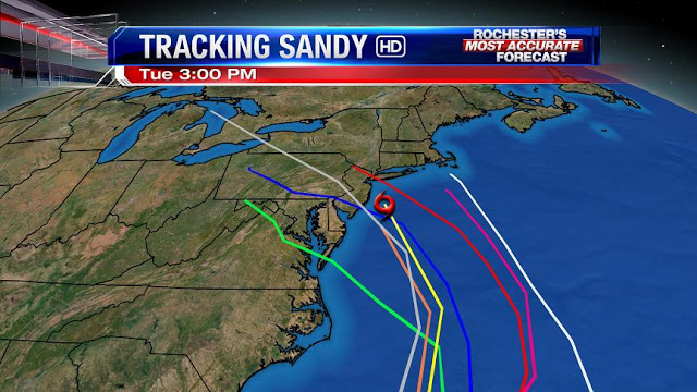
Latest guidance continues to suggest Hurricane Sandy morphing into a big Northeaster and making landfall between the Delmarva and Eastern Long Island sometime on Monday. This storm will bring the most damage to coastal areas with power outages and strong winds. Being a tropical system, there will be very heavy rain in parts of New Jersey, Pennsylvania, New York, and Maryland. It’s still WAY too early to be sure but the one event it reminds me of most is Agnes in 1972.
I’m most concerned about Northeast PA at this point as they are quite prone to excessive rain there along the Susquehanna. Our area can absorb quite a bit with the Mt. Morris Dam in place but minor flooding cannot be ruled out here.
Updates to follow on the blog as well as Facebook and Twitter!
RochesterHomepage.net/
2012-10-25 15:41:16
Source: http://rhpweatherblog.blogspot.com/2012/10/sandy-strikes-early-next-week.html
